Attached files
EXHIBIT 10.50
EXPLORATION AND DEVELOPMENT AGREEMENT
WITH AREA OF MUTUAL INTEREST
EAST NESSON PROJECT
MOUNTRAIL COUNTY, NORTH DAKOTA
This Exploration and Development Agreement with Area of Mutual Interest (this “Agreement”) dated effective as of the 1st day of January, 2007 (the “Effective Date”), is by and between Slawson Exploration Company, Inc., a Kansas corporation, whose principal place of business is 727 North Waco, Suite 400, Wichita, Kansas 67203 (hereafter “SECI”), and Chandler Energy, LLC, 475 17th Street, Suite 1210, Denver, Colorado 80202 (hereafter “Participant”).
Whereas, SECI has acquired certain oil and gas leases and options covering lands within the East Nesson Project Area located In Mountrail County, North Dakota which is described on Exhibit “A” attached hereto, said Area being hereafter referred to as the “Project Area”.
Whereas, Participant wishes to participate with SECI in the evaluation, leasing, drilling, and development of the Project Area pursuant to the provisions of this Agreement and the agreements through which SECI acquires leasehold rights within the Project Area.
Now therefore, the parties hereto, for the mutual promises contained herein and other good and valuable consideration, the sufficiency of which is hereby acknowledged, do hereby contract and agree as follows:
1. Participation Interest: By execution of this Agreement, Participant agrees to participate with a 10% working Interest ownership (“Participation Interest”) in the exploration and development of the Project Area and agrees to pay Its Participation Interest share of all costs Incurred In the Project Area pursuant to the terms set out herein. Participant agrees that any Interest acquired from SECI by Participant shall be specifically subject to the terms of the leases, options, farm-in options, seismic options and other agreements by which leasehold interests are acquired in the Project Area by SECI.
2. Advanced Expenses: Upon execution of this Agreement, Participant shall remit its Participation Interest share, as calculated in Paragraph 6 below of Six Million Dollars ($6.000.000) to be applied toward expenditures by SECI for the acquisition of leasehold within the Project Area. In a like manner, SECI will continue to request additional amounts to cover amounts it reasonably expects to incur for ongoing leasehold acquisition expenditures within the Project Area. SECI shall invoice Participant for its share of the advance, and Participant will have fifteen (15) business days from receipt of such invoice in which to remit payment of such invoice or notify SECI in writing of its election to withdraw from participation in the Project Area. Failure to remit this advance payment on or before the end of such fifteen-day period will be deemed an election to withdraw from the Project Area and Participant shall not be entitled to any further leasehold acquired unless the payment is made within five (5) business days of a second and final notice of the advance payment. Participant will be entitled to its Participation
1
Interest share of any leases acquired with funds billed to and paid by Participant pursuant to this paragraph.
As to leasehold costs other than bonus, brokerage or option payments incurred in any month during which Participant was participating in leasehold expenditures, for any portion of that month, Participant will be responsible for advancing its share (as set for the Paragraph 6 hereof) of such costs, regardless of the status of Participant at the time of billing. Upon Participant’s withdrawal from future acquisitions within the Project Area, Participant will not be responsible for such leasehold costs beginning with costs incurred in the month following Participant’s withdrawal, unless such costs are attributable to leasehold previously earned by Participant.
Participant’s participation under this Agreement is limited to Participant’s expenditure of a net $750.000.00, inclusive of advanced expenses, for leasehold acquisition (bonus, lease, maintenance and brokerage combined). After Participant’s net expenditure of $750,000.00, Participant may withdraw from future acreage acquisitions, but may only do so in writing by giving thirty (30) days advance written notice to SECI of Participants intent to withdraw from the acquisition of additional leasehold rights, otherwise Participant shall continue and shall be responsible for Its proportionate share of costs up lo and until the date said written notice is given to SECI.
3. Participation Following Withdrawal: Should Participant elect, or deemed to have elected to withdraw from the Project Area, Participant will not be entitled to participate in any future acquisitions of leasehold. However, Participant will be entitled to participate in any lease extension, renewal or acquisition of new leasehold interest covering only those leases in which Participant has earned an interest hereunder, as well as participate in subsequent drilling with its Participation Interest share of those earned leases. Participant will have twenty (20) days from receipt of a notice of lease extension, renewal or new acquisition to either: 1) participate in the acquisition as to its proportionate share; or 2) elect not to participate in the acquisition. Failure to make a written election within twenty (20) days shall be deemed an election to not participate in the acquisition.
In the event Participant and SECI drill a well in a spacing unit in which leases are owned by Participant, Participant shall be only entitled to participate in any contractual agreements for the acquisition of leasehold interest covering only those contracts entered into during the time in which Participant is participating hereunder, as well as participate in subsequent drilling with its Participation Interest share under those agreements. If Participant elects to participate in such contracts or agreements under this paragraph, Participant shall pay the leasehold and drilling costs associated with the provisions of the contractual agreements in accordance with the terms of this Agreement. Participant shall not be entitled to participate in any future contractual agreements for the acquisition of leasehold Interests entered into after Participant has elected or has been deemed to withdraw from this Agreement, provided, however, if a third party gives support for the drilling of a well in which Participant is participating and no acreage is being earned in the spacing unit for the well being drilled, then Participant shall have the right to participate in the support earned at the Participation Interest of Participant in the earning well, subject to reduction as provided for herein.
2
4. Reconciliation of Advanced Costs: SECI will reconcile advance payments made by Participant with actual costs incurred for lease acquisitions made pursuant to this Agreement on a semi-annual basis, if Participant withdraws or is deemed to have withdrawn from participation in the Project Area, then a reconciliation will be provided within ninety (90) days from the effective date of the withdrawal, and any advanced funds which are not used for lease acquisition expenses for leases earned by Participant will be refunded to Participant. The Parties agree that at such time as lease acquisitions within the Project Area are approximately ninety percent (90%) complete, SECI will no longer be required to submit requests for advance funds, and Participant will be required to participate with any future acquisitions within the Project Area in accordance with the terms hereof.
5. Geophysical and Geological Data: Participant shall own in proportion to its Participation Interest to the extent permitted under any data acquisition or license agreement and shall have access to review all geophysical and exploration data acquired by SECI within the Project Area and to the extent permitted under any data acquisition or license agreement and upon request by Participant, Participant may obtain copies and files at their own expense, for use in its offices under terms of strict confidentiality for the benefit of Participant. Participant agrees to participate for its proportionate interest share of costs in any new seismic data acquisition operated by SECI plus an amount equal to five percent 5% of Participant’s share of all costs. Geological and geophysical data may be acquired if at least 65% working interest of the total participants in the Project Area, whose interest is derived from SECI, approve such acquisition program. Participant agrees to participate for its proportionate interest in any new seismic data acquisition in which SECI is not the operator. Participant shall not be charged for SECI Internal G&A for review, acquisition and interpretation of geological or geophysical data. Upon request, SECI will review with Participant any maps or data on the Project Area which SECI develops relative to the exploration and development of the Project Area. Any data made available to Participant shall be held by Participant on a confidential basis and not sold, traded, or disclosed to any third party either directly or indirectly, without the express written consent of SECI, which consent shall not be unreasonably withheld but may be withheld to protect the rights of SECI, Participant or other parties participating in the acquisition of the data. Prior to the acquisition of new seismic data under this paragraph, SECI shall proposed the program to Participant and the other parties who may be involved in the acquisition, giving the particulars of the seismic program, cost involved and the estimated time of expenditures to acquire the data. SECI shall also, at Participants written request, furnish updates on the program and related expenses.
6. Participation Terms:
a. Land and Lease costs. Participant agrees to pay its Participation Interest share plus an amount equal to fifty percent (50%) of Participant’s share of all costs incurred for the acquisition of the leases and lease options set out on Exhibit “B” attached hereto, including, but not limited to lease bonus, brokerage charges, acquisition title costs and other miscellaneous costs and fees directly attributable to such leases, exclusive of drilling and division order title opinions. It being the intention of the parties that Participant shall pay for the continuing title costs on a promoted basis, only as to those leases listed on Exhibit “B”. In the event of title failure or other reasons that prevent SECI from acquiring a lease described on Exhibit “B”, Participant will be credited for all charges inclusive of the promote. As to those leases committed and acquired after
3
February 16, 2007 and not included on Exhibit “B”, Participant agrees to pay its Participation Interest share plus an amount equal to twenty-five percent (25%) of Participant’s share of all costs incurred for the acquisition of leases and lease options, (excluding those leases listed on Exhibit “B” hereto) including, but not limited to lease bonus, brokerage charges, title costs and other miscellaneous costs and fees directly attributable to the Project Area exclusive of drilling and division order title opinions. Participant will pay its Participation Interest share of all delay rental payments made on leases earned by Participant within the Project Area.
For the purposes herein, committed leases are those leases that have been mailed out but not acquired, with the verbal intent of SECI to acquire, and confirmation of lessor to lease, the leasehold on specific lands in the Project Area to SECI. Further, pursuant to Paragraph 2 herein, SECI has estimated the cost of the leases on Exhibit “B” to be $550,000 inclusive of the promote for Participant’s Participation Interest share of expenses associated with the leasehold on Exhibit “B”. The remaining monies in the amount of $50,000 are deemed to be an advance for ongoing leasing.
b. Other Costs. Except as otherwise stated herein, Participant shall pay, on an actual cost basis, its Participation Interest share of operating expenses incurred in the Project Area or chargeable under the applicable Joint Operating Agreement to operations for wells within the Project Area in which Participant elects to participate pursuant to the provisions of this Agreement, or in which Participant is obligated to participate by the execution of this Agreement.
7. Backin: SECI hereby reserves unto itself a ten percent (10%) backin working interest, proportionately reduced by Participant’s gross working interest in each drillsite spacing unit, after payout of each “Well Package” drilled in the Project Area. Upon payout of each Well Package, SECI shall have the right, but not the obligation to receive from Participant a proportionate 10% backin working interest in the drillsite spacing unit or pooled unit for each well in the Well Package and the equipment appurtenant thereto. For the purposes of this Paragraph 6, “Well Package” shall mean an accumulation of up to the first four (4) consecutive wells drilled under the terms of this Agreement in which Participant elects to participate. Should payout be reached as to the wells in a Well Package prior to the spudding of the four wells being drilled in the Well Package, then only the wells that have spudded will be included in the Well Package at payout shall be deemed to comprise the Well Package. It being the intention when payout occurs, only those wells in the package shall be counted for payout and new Well Packages shall be formed for subsequent four (4) well packages under the terms of this paragraph.
“Payout” as used herein shall mean the recovery by Participant from the proceeds of the sale of production from wells in the Well Package drilled hereunder (less applicable taxes, landowner’s royalty, overriding royalty, including the overriding royalty granted herein, and other burdens, if any), of all costs incurred by Participant in drilling, testing, completing and equipping the wells through the tanks (including gas sales lines and all other surface equipment) lease bonus costs, seismic costs allocated to a Well Package by the mutual consent of SECI and Participant and all other costs incurred in operating said wells during the recovery period, including the applicable promote.
4
Upon recovery of such costs as provided above, SECI shall notify Participant in writing of payout and in the event, SECI elects to receive an assignment of the backin interest, the assignment shall be effective at 7:00 A.M. on the first day of the month following the month in which payout occurred. SECI and Participant agree to execute such formal assignments or other instruments as may be reasonably necessary to evidence the terms of this provision.
8. Drilling Proposals: SECI will develop a drilling program focusing on a logical development of the Project Area. SECI will generally be responsible for initiating well proposals to Participant and other parties participating; however, any party who/which owns an interest in the lease(s) within the unit on which the well is to be proposed may recommend to SECI the drilling of a well. If SECI receives a well recommendation from Participant relative to a proposed location and SECI does not initiate a well proposal comparable to that received from Participant for circulation to all participants within thirty (30) days of receipt of Participant’s drilling recommendation, then Participant may initiate a proposal relative to such proposed site.
A well shall be proposed by the Parties by mailing to all working interest owners a proposal identifying the location of the well to be drilled, the estimated spud date, the objective(s) to be tested, the geological and/or geophysical basis for the proposed well, and an Authority for Expenditure (“AFE”). Parties receiving this well proposal will have twenty (20) days from the date of receipt to elect to either (1) participate as to their working interest in the proposed drilling venture, or (2) elect not to participate in the proposed drilling venture. Elections shall be made in writing to the party proposing the well. Failure to timely elect shall be deemed to constitute an election not to participate in the proposed drilling venture. Any Participant electing not to participate in the well shall forfeit all rights within the drill site section plus the 8 sections cornering or adjoining the drill site section (as to acreage located outside the boundary of an existing spacing unit on which a producing or drilling well is located, or on which a well has been proposed hereunder, and in which Participant has elected to participate) and shall reassign to SECI, all such leasehold working interest which it owns in the drill site section plus the 8 sections cornering or adjoining the drill site section at no cost to SECI. Notwithstanding the foregoing, however, in order for any such forfeiture to occur and be binding on the non-participating Participant, SECI must commence, or cause to be commenced and pursue with due diligence the operation set out in proposal within a period of ninety (90) days after the date of the expiration of the election period.
Except for participation elections and penalties resulting from those elections on the well which are governed by the prior paragraph, the drilling of the well and any subsequent well and well proposals on the same spacing unit shall be governed by the Joint Operating Agreement, (“JOA”), attached hereto as Exhibit “C”, with the Contract Area for such operating agreement being the spacing unit in which the well is drilled. In the event of a conflict between the terms of this Agreement and the JOA, the terms of this Agreement shall prevail.
9. Funding Obligation - Well Costs: As to each well in which Participant has elected to participate pursuant to this Agreement, Participant agrees to pay its proportionate share plus an amount equal to five percent (5%) of Participant’s share of that amount of completed well costs or through a frac, whichever is the latter. Participant shall make payment to SECI within fifteen (15) days of receipt of such notice or five (5) days prior to the projected spud date of a well,
5
whichever is the latter, to assure prompt payment of the drilling contractor. In the event the drilling contractor for a well requires that certain costs be prepaid into the drilling contractor’s escrow account prior to spud, the above said notice may require Participant and SECI to make the above said payment to an escrow account. Failure to timely make such payment or to make payment within fifteen (15) days following receipt of written notice of failure to make such payment shall constitute, at the non-defaulting Party’s election, an election by the defaulting Party not to participate in the well. The non-defaulting Party, at its option, may either declare the defaulting Party to be a non-participating Party in the well or require payment of the amount due from the defaulting Party based upon the election on the well previously made by the defaulting party.
To the extent possible under any existing agreements, SECI shall offer to Participant the right to participate for its proportionate Participation Interest in any interest forfeited to SECI under this Paragraph 9 from other participants in the spacing unit for a well. Participant’s participation shall be on the terms contained in this Agreement.
10. Net Revenue Interest: Participant shall acquire from SECI a delivered net revenue in all leasehold acquired in the Project Area equal to the delivered net revenue acquired by SECI, less an overriding royalty Interest of 3%. Notwithstanding the foregoing, Participant shall not receive a delivered net revenue of less than 77% unless the delivered net revenue received by SECI is less than 77%, in which case the leasehold will be assigned to Participant at the same delivered net revenue received by SECI.
11. Leasehold: SECI shall be responsible for acquiring leases by direct purchase and/or pursuant to option agreements or other contractual agreements and shall, assign to Participant its Participation Interest in said lease(s) immediately after the first sales from a producing well on the spacing unit for the leases to be assigned unless otherwise requested in writing by Participant for good cause. SECI shall be responsible for maintenance of leases within the Project Area and shall timely remit lease payments, rental and option extensions when due, and comply with the other obligations of the lease(s) and option agreements on behalf of Participant. SECI shall not be liable for either direct or consequential damages resulting from SECI’s failure to timely make lease payment, rental or extension payment absent a showing of gross negligence, willful misconduct or wanton disregard of responsibilities in the failure to make such payment. In the event Participant elects to participate in the lease payment, rental or option extension, Participant agrees to bear its proportionate share of any such payment incurred by SECI in its behalf.
12. Billings: Except as otherwise provided above, billings attributable to Participant’s interest in leases and operated wells shall be billed and payable pursuant to the accounting provisions of the applicable JOA.
13. AMI: There will be no Area of Mutual Interest for this Agreement. Both Participant and SECI agree that the leasehold acquisition and seismic data acquisition, if any, shall be conducted within the Nesson play in Mountrail County, North Dakota.
14. Term: The terms of this Agreement shall bind the Parties as to activities on the leasehold acquired pursuant to this Agreement for a period of sixty (60) months from the date of this
6
Agreement, or so long as an applicable JOA remains in effect within the boundaries of a spacing unit.
15. Notices: All notices required hereunder shall be considered given when delivered personally, or when received by facsimile or US Mail, properly addressed as follows:
Slawson Exploration Company, Inc.
727 North Waco. Suite 400
Wichita, KS 67203
Phone: (316) 263-3201
Fax: (316) 268-0702
Chandler Energy, LLC
475 17th Street, Suite 1210
Denver, CO 80202
Phone: 303-297-2028
Fax: 303-297-2196
Collis P. Chandler [Chandler@chandlerenergy.net]
16. Nature of Agreement: The liabilities of the parties shall be several and not joint or collective and each party shall be responsible only for its share of the costs and liabilities incurred as provided hereunder. It is not the purpose or intention of this Agreement to create any partnership, mining partnership, or association, and neither this Agreement nor the operations hereunder shall be construed or considered as creating any such legal relationship.
17. Marketing: The Operator shall be responsible for marketing 100% of the production from the wells drilled pursuant to this Agreement, and shall account to Participant for its proportionate share thereof. Participant, however, shall have the right to take and market its production in kind, but in doing so shall also assume the obligations of disbursing revenue to royalty and any others burden to its interest.
18. Operations: SECI will be the operator of the Project Area, including drilling and production phases of spacing units. In the event multiple third party working interest owners exist in a proposed spacing unit for a well, Participant shall nominate SECI as operator for the spacing unit. If SECI shall elect not to participate in a proposed well, then the parties in the spacing unit for the well shall elect a new operator for the drilling of the well.
19. Miscellaneous Provisions:
a. Subject to the other provisions of this Agreement, this Agreement, and all provisions hereof, shall inure to the benefit of, and be binding upon, not only the parties hereto, but their respective heirs, successors, and assigns. The leasehold rights and contractual rights acquired herein by Participant shall not be transferred, sold or assigned without the express written consent of SECI, which shall not be unreasonably withheld. If Participant, after receiving a recorded leasehold assignment, encumbers, hypothecates, mortgages, or pledges any or all interests so acquired from SECI, Participant nevertheless expressly agrees that SECI has a first and prior right of lien and
7
offset against any revenues payable to Participant to the extent of any delinquent and unpaid expenses then and thereafter owned to SECI, and Participant expressly agrees that such first and prior right of lien and offset will be preserved in favor of SECI in any documents executed by Participant which create an encumbrance.
b. The paragraph headings of this Agreement are inserted for convenience only, and should not be considered a part of this Agreement or used in its interpretation.
c. The parties hereto agree that all disputes between them arising out of, or in connection with, this Agreement shall be resolved by arbitration as provided herein. This agreement to arbitrate shall be conducted pursuant to the Commercial Arbitration Rules of the American Arbitration Association. If available, the panel used shall be selected from arbitrators having at least 10 years of oil and gas experience and employed by American Arbitration Association and the decision of the arbitrators shall be the final and binding on all parties. All arbitration shall be undertaken pursuant to the Federal Arbitration Act, where applicable, and the decision of the arbitrators shall be enforceable in any court of competent jurisdiction.
The parties involved in the arbitration agree that, within 30 days of the notice of arbitration, each party shall submit to the arbitration panel, their respective desired outcome of the arbitration, together with supporting data that was used in developing the outcome. The arbitration panel will hold hearings during which the parties may submit additional evidence. The arbitration panel will then be required to adopt one parties’ desired outcomes and the panel will not have discretion to alter the desired outcome selected.
This Agreement shall be governed by and construed in accordance with the laws of the State of Kansas.
d. The provisions of this Agreement are intended to be severable. If any term or provision hereof is illegal or invalid for any reason whatsoever, such illegality or invalidity shall not affect the legality or validity of the remainder of this Agreement.
e. This Agreement constitutes the entire understanding of the parties in respect to the subject matter hereof, in lieu of any prior agreement, and no amendment, modification, or alteration of the terms hereof shall be binding unless the same be in writing and signed by the party(ies) for whom/which it is sought to be enforced.
8
Executed effective as of the day and year first above written.
| Participant: | ||
| Chandler Energy, LLC | ||
| By: | /s/ Collis P. Chandler | |
| Collis P. Chandler | ||
| Slawson Exploration Company, Inc. | ||
| By: | /s/ Robert Todd Slawson | |
| Robert Todd Slawson | ||
9
EXHIBITS
| Exhibit |
Description | |
| A | East Nesson Project Area | |
| B | Lease Schedule | |
| C | 1) Vertical Joint Operating Agreement | |
| 2) Horizontal Joint Operating Agreement | ||
7
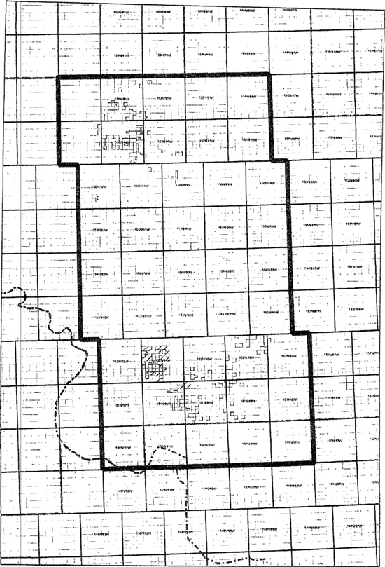
East Nesson Project Area
Exhibit A
EXHIBIT ‘B’
NORTH STANLEY TREND PROSPECT
MOUNTRAIL COUNTY, ND
| No. |
TWP RGE |
Sec. | Legal Description |
Gross Acres |
Net Acres |
Mailout | ||||||||||||
| 001 | T156N-90W | 8 | SW 1/4SE 1/4 | 655 | * | |||||||||||||
| 17 | Lot 1(15.00), NW 1/4NE 1/4, S 1/2NE 1/4, SE 1/4, W 1/2 | |||||||||||||||||
| 002 | T157N-91W | 17 | E 1/2NE 1/4 | 616.3 | * | |||||||||||||
| 19 | NE 1/4, NE 1/4SE 1/4, Lot 6(24.50) | |||||||||||||||||
| 20 | NW 1/4, N 1/2SW 1/4, Lot 1(33.80), Lot 2(38.00) | |||||||||||||||||
| 003 | T157N-91W | 18 | Lots 3(38.58) 4(38.70), E 1/2SW 1/4 | 557.28 | * | |||||||||||||
| T157N-92W | 1 | SE 1/4 | ||||||||||||||||
| 12 | SE 1/4, S 1/2NE 1/4 | |||||||||||||||||
| 004 | T157N-91W | 17 | All | 1,277.74 | * | |||||||||||||
| 18 | E 1/2NE 1/4, SE 1/4 | |||||||||||||||||
| 19 | Lots 1(38.81), 2(38.93), E 1/2NW 1/4 | |||||||||||||||||
| 20 | SE 1/4 | |||||||||||||||||
| T157N-92W | 24 | E 1/2NE 1/4 | ||||||||||||||||
| 005 | T157N-91W | 14 | S 1/2 | 1,120.00 | * | |||||||||||||
| 15 | S 1/2 | |||||||||||||||||
| 20 | NE 1/4 | |||||||||||||||||
| 21 | N 1/2 | |||||||||||||||||
| 005A | T157N-91W | 14 | S 1/2 | * | ||||||||||||||
| 15 | S 1/2 | |||||||||||||||||
| 20 | NE 1/4 | |||||||||||||||||
| 21 | N 1/2 | |||||||||||||||||
| 006 | T157N-91W | 1 | S 1/2S 1/2 | 484.06 | * | |||||||||||||
| 12 | W 1/2E 1/2 | |||||||||||||||||
| 11 | a 4.06 A Tract | |||||||||||||||||
| 006A | T157N-91W | 1 | S 1/2S 1/2 | * | ||||||||||||||
| 12 | W 1/2E 1/4, SW 1/4 | |||||||||||||||||
| 006B | T157N-91W | 1 | S 1/2S 1/2 | * | ||||||||||||||
| 12 | W 1/2E 1/2, SW 1/4 | |||||||||||||||||
| 007 | Lost to competition | |||||||||||||||||
| 008 | Lost to competition | |||||||||||||||||
| 009 | T156N-91W | 2 | SW 1/4 | 1,120.00 | * | |||||||||||||
| T157N-90W | 28 | SW 1/4NE 1/4 | ||||||||||||||||
| T157N-91W | 12 | SE 1/4SE 1/4 | ||||||||||||||||
| 13 | N 1/2N 1/2, S 1/2NE 1/4, SW 1/4NW 1/4, N 1/2S 1/2 | |||||||||||||||||
| 14 | N 1/2 | |||||||||||||||||
| 158N-91W | 20 | S 1/2NE 1/4 | ||||||||||||||||
| 21 | SW 1/4SW 1/4 | |||||||||||||||||
| 009A | 157N-91W | 12 | SE 1/4SE 1/4 | * | ||||||||||||||
| 13 | N 1/2N 1/2, S 1/2NE 1/4, SW 1/4NW 1/4, N 1/2S 1/2 | |||||||||||||||||
| 14 | N 1/2 | |||||||||||||||||
| 010 | T157N-90W | 30 | Lot 4(39.47) | 999.05 | * | |||||||||||||
| 31 | Lot 1(39.58) | |||||||||||||||||
| T157N-91W | 23 | NE 1/4NE 1/4, SE 1/4, NW 1/4NE 1/4, S 1/2NE 1/4 | ||||||||||||||||
| 24 | SW 1/4NW 1/4, W 1/2SW 1/4 | |||||||||||||||||
| 25 | SW 1/4, W 1/2NW 1/4, S 1/2SE 1/4 | |||||||||||||||||
| 26 | NE 1/4 | |||||||||||||||||
| 011 | T157N-91W | 21 | SE 1/4 | 160 | * | |||||||||||||
| 012 | T152N-91W | 9 | Lot 8(30.92), S 1/2SE 1/4 (Southern Play) | 492.61 | * | |||||||||||||
| 10 | Lots 5(30.88), 6(30.81), S 1/2SW 1/4 | |||||||||||||||||
| 16 | N 1/2NE 1/4, NW 1/4 | |||||||||||||||||
| 012A | T152N-91W | 9 | S 1/2SE 1/4 (Southern Play) | * | Mailout | |||||||||||||
| 16 | NW 1/4, N 1/2NE 1/4 | |||||||||||||||||
EXHIBIT ‘B’
NORTH STANLEY TREND PROSPECT
MOUNTRAIL COUNTY, ND
| No. |
TWP RGE |
Sec. | Legal Description |
Gross Acres |
Net Acres |
Mailout | ||||||||||||
| 013 | T157N-91W | 10 | N 1/2SE 1/4 | 720 | * | |||||||||||||
| 013A | T157N-91W | 10 | N 1/2SE 1/4 | * | ||||||||||||||
| 11 | S 1/2 | |||||||||||||||||
| 16 | W 1/2 | |||||||||||||||||
| 013B | T157N-91W | 10 | N 1/2SE 1/4 | * | ||||||||||||||
| 11 | S 1/2 | |||||||||||||||||
| 16 | W 1/2 | |||||||||||||||||
| 014 | T157N-91W | 26 | S 1/2 | 480 | * | |||||||||||||
| 35 | E 1/2NE 1/4, NW 1/4SW 1/4, SW 1/4SE 1/4 | |||||||||||||||||
| 015 | T157N-90W | 7 | SE 1/4 | 160 | * | |||||||||||||
| 016 | T157N-90W | 25 | E 1/2SW 1/4 | 80 | * | |||||||||||||
| 017 | T157N-90W | 26 | SE 1/4 | 160 | * | |||||||||||||
| 018 | T158N-90W | 5 | W 1/2SW 1/4 | 80 | * | |||||||||||||
| 019 | T158N-90W | 6 | E 1/2SE 1/4 | 80 | * | |||||||||||||
| 020 | T158N-90W | 30 | Lot 4(37.81) | 37.81 | * | |||||||||||||
| 021 | T158N-90W | 31 | Lots 1,2,3,4, NE 1/4SW 1/4 | 191.36 | * | |||||||||||||
| 022 | T158N-91W | 2 | S 1/2 | 320 | * | |||||||||||||
| 023 | T158N-91W | 9 | SE 1/4 | 160 | * | |||||||||||||
| 024 | T158N-91W | 12 | NE 1/4 | 160 | * | |||||||||||||
| 025 | T158N-91W | 20 | SW 1/4 | 160 | * | |||||||||||||
| 026 | T158N-91W | 21 | SW 1/4 less a tract of 16.75 acres | 143.25 | * | |||||||||||||
| 027 | T158N-91W | 22 | E 1/2SW 1/4, W 1/2SE 1/4 | 160 | * | |||||||||||||
| 028 | T158N-91W | 25 | S 1/2SE 1/4 | 80 | * | |||||||||||||
| 029 | T158N-91W | 26 | S 1/2SE 1/4, SW 1/4 | 240 | * | |||||||||||||
| 030 | T158N-91W | 27 | NW 1/4 less 6.25 acres | 153.75 | * | |||||||||||||
| 031 | T158N-91W | 28 | NW 1/4 | 160 | * | |||||||||||||
| 032 | T158N-91W | 29 | S 1/2 | 320 | * | |||||||||||||
| 033 | T158N-91W | 29 | N 1/2 | 320 | * | |||||||||||||
| 034 | T158N-91W | 31 | E 1/2 | 320 | * | |||||||||||||
| 035 | T158N-91W | 34 | SE 1/4 less 6.35 acres | 153.38 | * | |||||||||||||
| 036 | T158N-91W | 35 | N 1/2NE 1/4, W 1/2 | 400 | * | |||||||||||||
| 037 | T155N-90W | 35 | All | 934.6 | * | |||||||||||||
| T156N-90W | 9 | W 1/2NW 1/4, NW 1/4SW 1/4, Lot 1(22.00) | ||||||||||||||||
| T157N-91W | 19 | E 1/2SW 1/4, NW 1/4SE 1/4, Lot 5(32.60) | ||||||||||||||||
| 038 | T152N-91W | 29 | NW 1/4 (Southern Play) | 160 | * | |||||||||||||
| 039 | T157N-91W | 21 | SW 1/4 | 320 | * | |||||||||||||
| 22 | SW 1/4NE 1/4, SE 1/4NW 1/4, N 1/2NW 1/4 | |||||||||||||||||
| 040 | T152N-91W | 28 | SE 1/4 (Southern Play) | 160 | * | |||||||||||||
| 040A | T152N-91W | 28 | SE 1/4 (Southern Play) | * | ||||||||||||||
| 041 | T152N-91W | 19 | NE 1/4 less Outlots 2,3, SE 1/4 less Outlot 1 | 483.27 | * | |||||||||||||
| 20 | N 1/2NW 1/4, NW 1/4NE 1/4, SW 1/4NW 1/4 (Southern) | |||||||||||||||||
| 30 | E 1/2NE 1/4 less Outlot 1, E 1/2W 1/2NE 1/4, | |||||||||||||||||
| NW 1/4NW 1/4NE 1/4, E 1/2NW 1/4SW 1/4NE 1/4, | ||||||||||||||||||
| E 1/2SW 1/4NW 1/4NE 1/4 less Outlot 2 | ||||||||||||||||||
| 042 | T152N-91W | 21 | SW 1/4 (Southern Play) | 160 | * | |||||||||||||
| 042A | T152N-91W | 21 | SW 1/4 (Southern Play) | * | ||||||||||||||
| 042B | T152-91W | 21 | SW 1/4 (Southern Play) | * | ||||||||||||||
| 043 | T152N-91W | 20 | SE 1/4 (Southern Play) | 640 | * | |||||||||||||
| 28 | W 1/2 | |||||||||||||||||
| 29 | NE 1/4 | |||||||||||||||||
| 043A | T152N-91W | 20 | SE 1/4 (Southern Play) | * | ||||||||||||||
| 043B | T152N-91W | 28 | NW 1/4 (Southern Play) | * | ||||||||||||||
| 043C | T152N-91W | 29 | NE 1/4 (Southern Play) | * | ||||||||||||||
| 043D | T152N-91W | 28 | NW 1/4 (Southern Play) | * | ||||||||||||||
| 043E | T152N-91W | 20 | SE 1/4 (Southern Play) | * | ||||||||||||||
| 043F | T152N-91W | 29 | NE 1/4 (Southern Play) | * | ||||||||||||||
| 043G | T152-91W | 20 | SE 1/4 (Southern Play) | * | Mailout | |||||||||||||
| 28 | NW 1/4 | |||||||||||||||||
| 29 | NE 1/4 | |||||||||||||||||
| 043H | T152-91W | 20 | SE 1/4 (Southern Play) | * | Mailout | |||||||||||||
| 28 | NW 1/4 | * | ||||||||||||||||
| 29 | NE 1/4 | * | ||||||||||||||||
| 044 | T152N-91W | 7 | Lots 7(26.18), 8(31.07), 9(31.07), 11(33.82) | 496.5 | * | |||||||||||||
| SE 1/4SW 1/4, S 1/2SE 1/4 (Southern Play) | ||||||||||||||||||
| 18 | Lots 1(33.83), 2(33.76), E 1/2NW 1/4 | |||||||||||||||||
EXHIBIT ‘B’
NORTH STANLEY TREND PROSPECT
MOUNTRAIL COUNTY, ND
| No. |
TWP RGE |
Sec. | Legal Description |
Gross Acres |
Net Acres |
Mailout | ||||||||||
| 19 | Lots 1(33.50), 33.28), NE 1/4NW 1/4 | |||||||||||||||
| 045 | T152N-91W | 20 | SW 1/4 (Southern Play) | 160 | * | |||||||||||
| 045A | T152N-91W | 20 | SW 1/4 (Southern Play) | * | ||||||||||||
| 046 | T152-91W | 21 | SW 1/4 (Southern Play) | 320 | * | |||||||||||
| 28 | NE 1/4 | |||||||||||||||
| 047 | T152-91W | 16 | SW 1/4 (Southern Play) | 160 | * | Mailout | ||||||||||
| 047A | T152-91W | 16 | SW 1/4 (Southern Play) | * | Mailout | |||||||||||
| 047B | T152-91W | 16 | SW 1/4 (Southern Play) | * | Mailout | |||||||||||
| 048 | T152-91W | 9 | Lots 2(14.58), 3(14.54), 4(14.50), (Southern Play) | 216.46 | * | |||||||||||
| 5(30.96), 6(30.94), 7(30.94), S 1/2SW 1/4 | ||||||||||||||||
| 048A | T152-91W | 9 | Lots 2(14.58), 3(14.54), 4(14.50), (Southern Play) | * | Mailout | |||||||||||
| 5(30.96), 6(30.94), 7(30.94), S 1/2SW 1/4 | ||||||||||||||||
| 048B | T152N-91W | 9 | Lots 2(14.58), 3(14.54), 4(14.50), (Southern Play) | * | Mailout | |||||||||||
| 5(30.96), 6(30.94), 7(30.94), S 1/2SW 1/4 | ||||||||||||||||
| 049 | T152-91W | 27 | W 1/2NW 1/4, NE 1/4NW 1/4, W 1/2SE 1/4NW 1/4 (Southern Play) | 780 | * | Mailout | ||||||||||
| 33 | NE 1/4 | |||||||||||||||
| T151-92W | 7 | SE 1/4 | ||||||||||||||
| 17 | N 1/2 | |||||||||||||||
| 050 | T152N-91W | 7 | Lots 3(14.47), 4(14.45), 5(14.43), S 1/2NE 1/4 | 617.83 | * | Mailout | ||||||||||
| 8 | Lot 4(14.48), NW 1/4 (Southern Play) | |||||||||||||||
| 17 | E 1/2 | |||||||||||||||
| 050A | T152N-91W | 7 | Lots 3(14.47), 4(14.45), 5(14.43), S 1/2NE 1/4 | 617.83 | * | Mailout | ||||||||||
| 8 | Lot 4(14.48), NW 1/4 (Southern Play) | |||||||||||||||
| 17 | E 1/2 | |||||||||||||||
| 050B | T152N-91W | 7 | Lots 3(14.47), 4(14.45), 5(14.43), S 1/2NE 1/4 | 617.83 | * | Mailout | ||||||||||
| 8 | Lot 4(14.48), NW 1/4 | |||||||||||||||
| 17 | E 1/2 (Southern Play) | |||||||||||||||
EXHIBIT ‘B’ (Continued)
PARSHALL PROSPECT
MOUNTRAIL COUNTY, ND
| Lease ID |
Lessor |
Exp. Date | TWP RGE | Sec. |
Legal Description |
Gross Acres |
Net Acres |
Mailout | ||||||||||||||||
| MT 002 | Waldock, James and Daniel Waldock, both married | * | 152N-89W | 32 | NW 1/4 | 1120.00 | * | |||||||||||||||||
| men dealing in their sole and separate property |
|
151N-90W |
|
25 | NE 1/4 |
|||||||||||||||||||
| 29 | S 1/2 | |||||||||||||||||||||||
| 30 | SE 1/4 | |||||||||||||||||||||||
| 32 | NW 1/4 | |||||||||||||||||||||||
| 33 | NW 1/4 | |||||||||||||||||||||||
| MT 002A | Waldock, Catherine | * | 152N-89W | 32 | NW 1/4 | 717.48 | * | |||||||||||||||||
| 151N-90W | 25 | NE 1/4, less a 2.52 acre ROW tract | ||||||||||||||||||||||
| 29 | SW 1/4 | |||||||||||||||||||||||
| 30 | SE 1/4 | |||||||||||||||||||||||
| 32 | NW 1/4 | |||||||||||||||||||||||
| MT 002B |
Waldock, Jean | * | 152N-89W | 32 |
NW 1/4 |
717.48 | * | |||||||||||||||||
| 151N-90W | 25 | NE 1/4, less a 2.52 acre ROW tract | ||||||||||||||||||||||
| 29 | SW 1/4 | |||||||||||||||||||||||
| 30 | SE 1/4 | |||||||||||||||||||||||
| 32 | NW 1/4 | |||||||||||||||||||||||
| MT 002C | Waldock, Richard | * | 152N-89W | 32 | NW 1/4 | 717.48 | * | |||||||||||||||||
| 151N-90W | 25 | NE 1/4, less a 2.52 acre ROW tract | ||||||||||||||||||||||
| 29 | SW 1/4 |
|||||||||||||||||||||||
| 30 | SE 1/4 |
|||||||||||||||||||||||
| 32 | NW 1/4 |
|||||||||||||||||||||||
| MT 002D | Bjelland, Monica | * | 152N-89W | 32 | NW 1/4 |
717.48 | * | |||||||||||||||||
| 151N-90W | 25 | NE 1/4, less a 2.52 acre ROW tract |
||||||||||||||||||||||
| 29 | SW 1/4 | |||||||||||||||||||||||
| 30 | SE 1/4 |
|||||||||||||||||||||||
| 32 | NW 1/4 |
|||||||||||||||||||||||
| MT 002E | Matsch, Rita | * | 152N-89W | 32 | NW 1/4 |
717.48 | * | |||||||||||||||||
| 151N-90W | 25 | NE 1/4, less a 2.52 acre ROW tract | ||||||||||||||||||||||
| 29 | SW 1/4 |
|||||||||||||||||||||||
| 30 | SE 1/4 |
|||||||||||||||||||||||
| 32 | NW 1/4 |
|||||||||||||||||||||||
| MT 002F | Waldock, John | * | 152N-89W | 32 | NW 1/4 |
717.48 | * | |||||||||||||||||
| 151N-90W | 25 | NE 1/4, less a 2.52 acre ROW tract |
||||||||||||||||||||||
| 29 | SW 1/4 |
|||||||||||||||||||||||
| 30 | SE 1/4 |
|||||||||||||||||||||||
| 32 | NW 1/4 |
|||||||||||||||||||||||
| MT 002G | Forrest, Mary E., and Harland Forrest, | * | 152N-89W | 32 | NW 1/4 | 160.00 | * | |||||||||||||||||
| wife and husband | ||||||||||||||||||||||||
| MT 002H | Loan, Marilyn | * | 152N-89W | 32 | NW 1/4 |
717.48 | * | |||||||||||||||||
| 151N-90W | 25 | NE 1/4, less a 2.52 acre ROW tract |
||||||||||||||||||||||
| 29 |
SW 1/4 |
|||||||||||||||||||||||
| 30 | SE 1/4 |
|||||||||||||||||||||||
| 32 | NW 1/4 |
|||||||||||||||||||||||
| MT 009 | Bartelson, John O., a widower, John H. Bartleson, Jr. | * | 151N-89W | 19 | NE 1/4 | 1440.28 | * | |||||||||||||||||
| a single man, and Janice B. Anderson aka Janice | 151N-90W | 2 | Lot 1(40.13), Lot 2(40.15), S 1/2NE 1/4, SE 1/4 | |||||||||||||||||||||
| K. Anderson aka Janice Anderson a married woman | 13 | NW 1/4 |
||||||||||||||||||||||
| 14 | All | |||||||||||||||||||||||
| 34 | NW 1/4 | |||||||||||||||||||||||
| MT 010 | Brendle, Ralph A. Revocable Living Trust dated | * | 151N-91W | 10 | S 1/2NE 1/4 | 1040.00 | * | |||||||||||||||||
| 7/1/05. Ralph A. Brendle. Trustee | 11 | N 1/2 | ||||||||||||||||||||||
| 12 | NE 1/4 | |||||||||||||||||||||||
| 152N-80W | 29 |
NW 1/4 | ||||||||||||||||||||||
| 32 | S 1/2NE 1/4, NW 1/4, N 1/4SW 1/4 | |||||||||||||||||||||||
| MT 010A | Brendle, V. Gail. Revocable Living Trust dated | * | 151N-91W | 10 | S 1/2NE 1/4 | 80.00 | * | |||||||||||||||||
| 7/1/05. V. Gail. Brendle, Trustee | ||||||||||||||||||||||||
| MT 010B | Youlsos, Gail | * | 151N-91W | 12 | NE 1/4 | 160 | * | mailout | ||||||||||||||||
| MT 014 | Kuehn, Jon E. a married man dealing in his sole | * | 151N-90W | 1 | Lot 2(40.05), SE 1/4, S 1/2NE 1/4, less a 3.80 acre tract, a 1.83 acre | 420.79 | * | |||||||||||||||||
| and separate property | tract, a 0.13 acre tract, and a 12.13 acre tract, Lot 3(40.07) | |||||||||||||||||||||||
| less a 1.77 acre tract, Lot 4(40.13), S 1/2NW 1/4 | ||||||||||||||||||||||||
| MT 021 |
Hoinzen, Robert, individually and as Trustee of the | * | 152N-89W | The N 1/2 of the following described tract: | 96.48 | * | ||||||||||||||||||
| Margery I. Heinzon Trust dated March 8, 2008 | 5 | S 1/2NE 1/4, Lots 1(58.44), 2(58.62) | ||||||||||||||||||||||
| MT 021A | Ackerman, Kay L. |
* | 152N-89W | The N 1/2 of the following described tract: | 96.48 | * | ||||||||||||||||||
| 5 | S 1/2NE 1/4 Lots 1(58.44), 2(58.52) | |||||||||||||||||||||||
| MT 026 | Braaflat, DuWayne and Dons V. Braaflat | * | 152N-89W | 2 | Lots 3(57.35), 4(57.26), S 1/2NW 1/4 | 983.4 | * | |||||||||||||||||
| husband and wife | 3 | SW 1/4 | ||||||||||||||||||||||
| 9 | NW 1/4 | |||||||||||||||||||||||
| 10 | NW 1/4 | |||||||||||||||||||||||
| 13 | NE 1/4 | |||||||||||||||||||||||
| 152N-88W | 6 | Lots 8(33.47), 7(33.63), E 1/4SW 1/4 | ||||||||||||||||||||||
| MT 026A | Braaflat, Craig and Joy R. Braaflat | * | 152N-89W | 2 |
Lots 3(57.35), 4(57.25), S 1/2NW 1/4 |
234.12 | * | |||||||||||||||||
| husband and wife | 3 | SW 1/2 | ||||||||||||||||||||||
| 8 | NE 1/4 | |||||||||||||||||||||||
| 10 | NW 1/4 | |||||||||||||||||||||||
| 19 | Lot 1(34.12), NE 1/4NW 1/4 | |||||||||||||||||||||||
| MT 026B | Boe, Kenneth and Bonnie Boe, husband and wife | * | 152N-89W | 9 |
NW 1/4 | 160.00 | * | |||||||||||||||||
| and Shirley Engeeden, a widow (heirs of Bertha | ||||||||||||||||||||||||
| Johnson, deceased) | ||||||||||||||||||||||||
| MT 027 | Duff Family Trust UAD 8/20/97, Edwin Ramend | * | 152N-89W | 3 | Lots 1 & 2, S 1/2NE 1/4 | 194.26 | * | |||||||||||||||||
| Duff and Lillian Emily Duff as Trustee | ||||||||||||||||||||||||
| MT 027A | Duff, Robert C., a married man dealing in his sole | * | 152N-89W | 3 | Lots 1 & 2, S 1/2NE 1/4 | 194.28 | * | |||||||||||||||||
| and separate property | ||||||||||||||||||||||||
EXHIBIT ‘B’ (Continued)
PARSHALL PROSPECT
MOUNTRAIL COUNTY, ND
| Lease ID |
Lessor |
Exp. Date | TWP RGE | Sec. |
Legal Description |
Gross Acres |
Net Acres |
Mailout | ||||||||||||||||
| MT 027B | Duff. Dolphine Ann, Individually and as Trustee of the Richard M. Duff Revocable Trust | * | 152N-89W | 3 | Lots 1 & 2, S 1/2NE 1/4 | 184.28 | * | |||||||||||||||||
| MT 027C | Duff, Donald R. and Shirley K. Duff, husband and wife | * | 152N-99W | 3 | Lots 1 & 2, S 1/2NE 1/4 | 184.28 | * | |||||||||||||||||
EXHIBIT ‘B’ (Continued)
PARSHALL PROSPECT
MOUNTRAIL COUNTY, ND
| Lease ID |
Lessor |
Exp. Date | TWP RGE | Sec. |
Legal Description |
Gross Acres |
Net Acres |
Mailout | ||||||||||||||||
| MT 029 |
Andes, Robert Jr. and Sharon Andes, | * | 152N-89W | 20 | NW 1/4 | 160.00 | * | |||||||||||||||||
| husband and wife | ||||||||||||||||||||||||
| MT 030 |
Nelson, Wallace L and Mary Ann Nelson |
* | 151N-90W | 27 | SE 1/4 | 639.52 | * | |||||||||||||||||
| husband and wife | |
151N-89W |
|
4 |
SW 1/4 | |||||||||||||||||||
| 5 | Lots 3(39.90), 4(39.88), S 1/2NW 1/4 | |||||||||||||||||||||||
| 8 | Lots 1(39.86), 2(39.90), S 1/2NE 1/4 | |||||||||||||||||||||||
| MT 031 |
Nelson, Wallace L And Mary Ann Nelson | * | 152N-89W | 1 | Lots 1(57.81), 2(57.75), S 1/2NE 1/4,SE 1/4 | 570.94 | * | |||||||||||||||||
| husband and wife | 12 | Lots 1(13.92), 2(13.82), NE 1/4, Lots 3(13.82), 4(13.82) | ||||||||||||||||||||||
| MT 032 |
Nelson, Wallace L. Life Estate | * | 152N-89W | 14 | NE 1/4 | 180.00 | * | |||||||||||||||||
| MT 033 |
Williamson, Wade F. Aka Wade F. Williamson Jr. | * | 151N-89W | 6 | Lots 3(39.94), 4(34.89), 5(34.78), 6(34.62), 7(34.47) | 925.23 | * | |||||||||||||||||
| and Cynthia J. Williamson husband and wife | SE 1/4NW 1/4, E 1/2SW 1/4 | |||||||||||||||||||||||
| Helen H. WiIliamson Res, Trust | 7 | Lots 1(34.46), 2(34.80), less a 2.51 A Tr., E 1/2NW 1/4 | ||||||||||||||||||||||
| 30 | SE 1/4 | |||||||||||||||||||||||
| 32 | NW 1/4 | |||||||||||||||||||||||
| 33 | NW 1/4 | |||||||||||||||||||||||
| MT 033B |
Anderson, Carol L. and Edward D. Andersen aka | * | 151N-89W | 6 | Lots 3(39.94), 4(34.89), 5(34.78).SE 1/4NW 1/4 | 149.61 | * | |||||||||||||||||
| Edward Anderson, wife and husband | ||||||||||||||||||||||||
| MT 033C |
Vorwerk, James A. | * | 151N-89W | 6 | Lot 6(34.62), 7(34.47), E 1/2SW 1/4 | 459.09 | * | |||||||||||||||||
| 30 | SE 1/4 | |||||||||||||||||||||||
| 32 | NW 1/4 | |||||||||||||||||||||||
| MT 033D |
Vorwark, Nancy | * | 151N-89W | 6 | Lot 6(34.62), 7(34.47), E 1/2SW 1/4 | 469.09 | * | |||||||||||||||||
| 30 | SE 1/4 | |||||||||||||||||||||||
| 32 | NW 1/4 | |||||||||||||||||||||||
| MT 033E |
Larson, Lots | * | 151N-89W | 6 | Lot 6(34.62), 7(34.47), E 1/2SW 1/4 | 469.09 | * | |||||||||||||||||
| 30 | SE 1/4 | |||||||||||||||||||||||
| 32 | NW 1/4 | |||||||||||||||||||||||
| MT 033F |
Schroeder, Dorothv J. | * | 151N-89W | 6 | Lot 6(34.62), 7(34.47), E 1/2SW 1/4 | 469.09 | * | |||||||||||||||||
| 30 | SE 1/4 | |||||||||||||||||||||||
| 32 | NW 1/4 | |||||||||||||||||||||||
| MT 033G |
Vorwerk, Harold G, | * | 151N-89W | 6 | Lot 6(34.62), 7(34.47), E 1/2SW 1/4 | 469.09 | * | |||||||||||||||||
|
30 |
SE 1/4 |
|||||||||||||||||||||||
| 32 | NW 1/4 | |||||||||||||||||||||||
| MT 033H |
Vorwerk, Wesley | * | 151N-88W | 6 | Lot 6(34.62), 7(34.47), E 1/2SW 1/4 | 469.09 | * | mailout | ||||||||||||||||
| 30 | SE 1/4 | |||||||||||||||||||||||
| 32 | NW 1/4 | |||||||||||||||||||||||
| MT 033I |
Zialicke, Esther | * | 151N-89W | 6 | Lot 6(34.62), 7(34.47), E 1/2SW 1/4 | 469.09 | * | mailout | ||||||||||||||||
| 30 | SE 1/4 | |||||||||||||||||||||||
| 32 | NW 1/4 | |||||||||||||||||||||||
| MT 034 |
Braaflat Craig and Joy R. Braaflat husband and wife | * | 152N-89W | 18 | E 1/2SW 1/4 | 80.00 | * | |||||||||||||||||
| MT 035 |
Waldock, Benedict Joseph, a widower | * | 152N-89W | 32 | NW 1/4 | 320.00 | * | |||||||||||||||||
| 151N-80W | 20 | SE 1/4 | ||||||||||||||||||||||
| MT 035A |
Schoepf, Valene, formerly Valene Waldock and | * | 152N-89W | 32 | NW 1/4 | 160.00 | * | |||||||||||||||||
| Michael Schoepf, wife and husband | ||||||||||||||||||||||||
| MT 038 |
Bergemann, William G. as A-in-F for Olive | * | 151N-89W | 6 | SE 1/4 | 160.00 | * | |||||||||||||||||
| Bergermann, a widow | ||||||||||||||||||||||||
| MT 038 |
Risen Limited Partnership, a ND Limited Partnership | * | 152N-89W | 30 | Lots 1(34.28), 2(34.33), E 1/2NW 1/4, NE 1/4 | 308.81 | * | |||||||||||||||||
| MT 039 |
WaLdock, Tom and Joyce Waldock | * | 151N-91W | 23 | E 1/2W 1/2NW 1/4,SE 1/4 | 1152.10 | * | |||||||||||||||||
| 24 | NE 1/4,E 1/2NW 1/4,SW 1/4 | |||||||||||||||||||||||
| 151N-90W | 19 | Lots 1(35.88), 2(36.12), E 1/2NW, NW 1/4SE 1/4, NE 1/4, E 1/2SE 1/4, NE 1/4 | ||||||||||||||||||||||
| 20 | W 1/2SE 1/4 | |||||||||||||||||||||||
| MT 039A |
Illene Msek | * | 151N-91W | 13 | SE 1/4, E 1/2SW 1/4 | * | ||||||||||||||||||
| 23 | E 1/2W 1/2, E 1/2W 1/2NW 1/4, SE 1/4 | |||||||||||||||||||||||
| 24 | E 1/2NW 1/4, SW 1/4 | |||||||||||||||||||||||
| MT 040 |
Waldock, Joe | * | 151N-91W | 12 | NW 1/4 | 1497.58 | * | |||||||||||||||||
| 13 | E 1/4, E 1/2SW 1/4 | |||||||||||||||||||||||
| 14 | W 1/2NE 1/4, SE 1/4 |
|||||||||||||||||||||||
| 23 | E 1/2W 1/2 |
|||||||||||||||||||||||
| 151N-90W | 18 |
NW 1/4 |
||||||||||||||||||||||
| 18 | Lot 3(35.91), 4(35.92), E 1/2SW, 1/4 | |||||||||||||||||||||||
| 19 | Lot 3(38.24) | |||||||||||||||||||||||
| 20 | W 1/2SE 1/4 | |||||||||||||||||||||||
| 29 | NE 1/4 | |||||||||||||||||||||||
| MT 041 |
Waldock, Benedict | * | 151N-91W | 13 | NE 1/4 | 160 | * | |||||||||||||||||
EXHIBIT ‘B’ (Continued)
SECI DIRECT LEASES
MOUNTRAIL COUNTY, ND
| No. |
TWP RGE |
Sec. |
Legal Description |
Gross Acres |
Net Acres |
Mailout | ||||||||||||
| T153N-88W |
9 | SE/4 | 160 | * | ||||||||||||||
[Confidential treatment has been requested with respect to the omitted portions of this exhibit. This copy omits information subject to a confidentiality request filed with the Securities and Exchange Commission. Omissions are designated with the character [*]. A complete version of this exhibit has been filed separately with the Securities and Exchange Commission along with the request for confidential treatment.]