Attached files
| file | filename |
|---|---|
| 8-K - HOUSTON AMERICAN ENERGY CORPORATION 8-K 9-11-2012 - HOUSTON AMERICAN ENERGY CORP | form8k.htm |
EXHIBIT 99.1

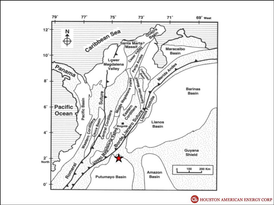
Serrania Area
Putumayo Basin
COLOMBIA
HOUSTON AMERICAN ENERGY CORP
Serrania
Serrania Area - Northern Putumayo Basin
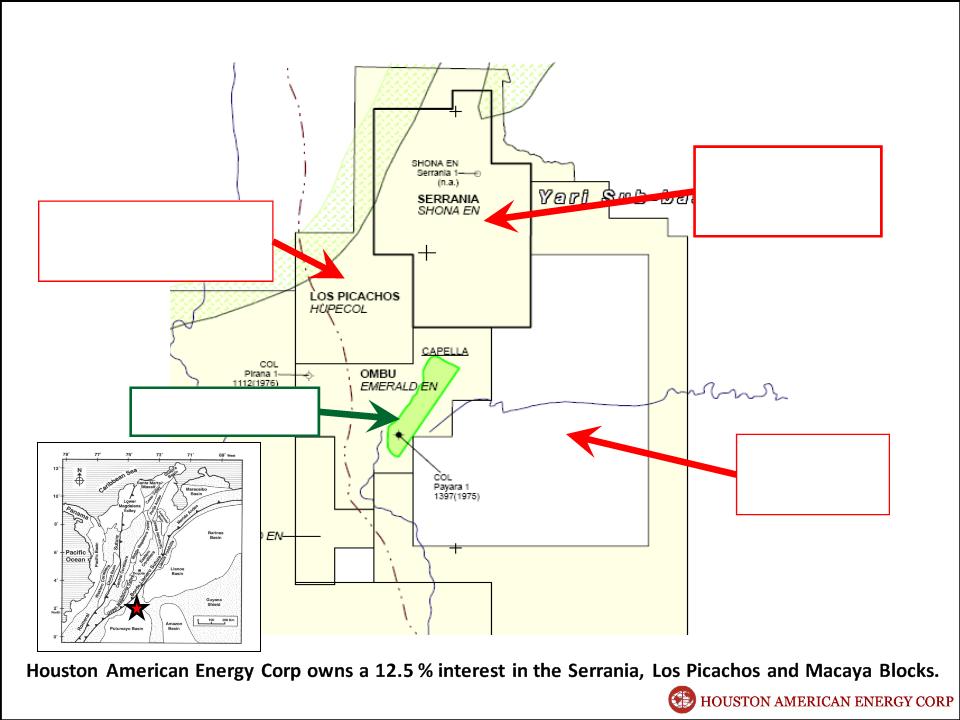
Los Picachos
86,249 acres
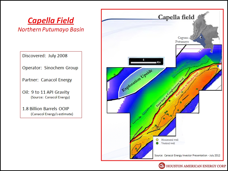
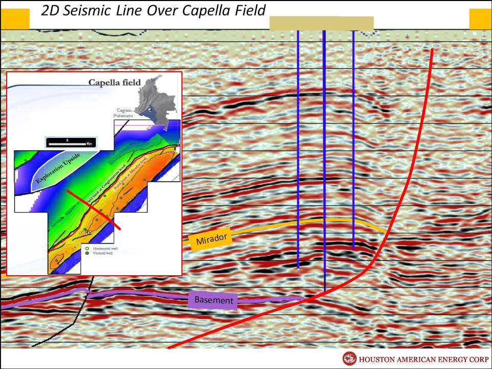
Capella Field
Macaya
195,201 acres
Serrania
110,790 acres
Northern Putumaya Basin
Serrania
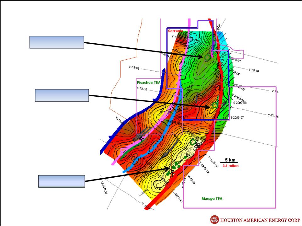
Capella Field
North Prospect
South Prospect
Serrania - Capella Area
Mirador Sand Time Structure Map
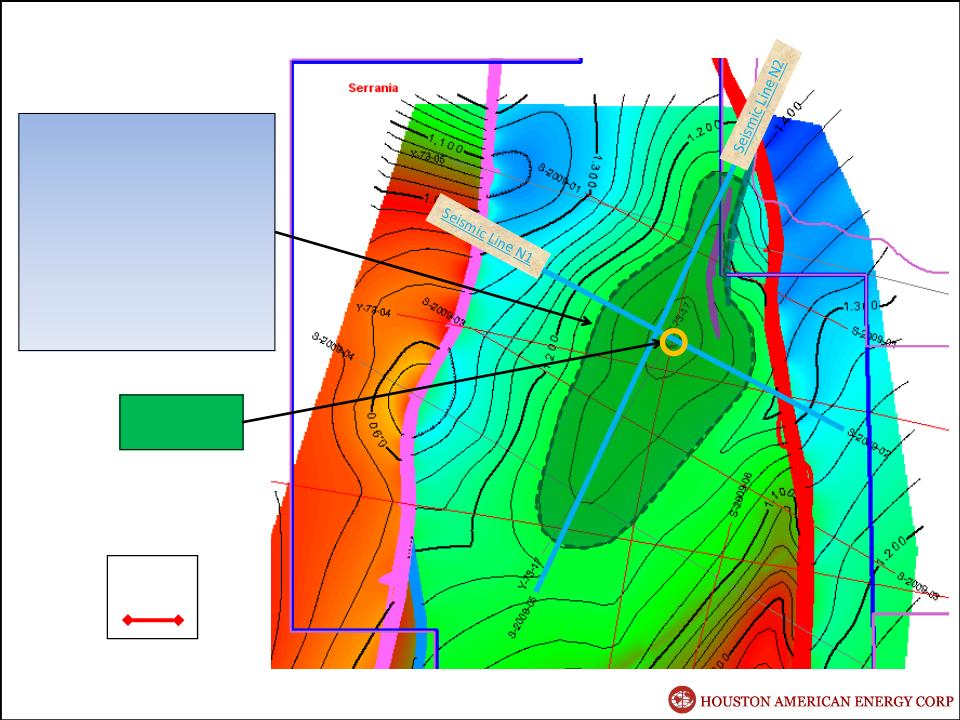
Prospect Statistics
Estimated Closure:
11,000 Acres
(17+ square miles)
45 msec
(approximately 180 feet)
Approximate Depth to
Top of Mirador: 4,500’
Serrania - North Prospect
1 Mile
Proposed
Well Location
Mirador Sand Time Structure Map

2D Seismic Line N1
NW
SE
Mirador
Basement
North Prospect

SW
NE
Mirador
Basement
2D Seismic Line N2
North Prospect

Prospect Statistics
Estimated Closure:
6,000 Acres
(9+ square miles)
80 msec closure
(approximately 320 feet)
Approximate Depth to
Top of Mirador: 3,600’
Serrania - South Prospect
1 Mile
Capella Field
Proposed
Well Location
Mirador Sand Time Structure Map
E
Mirador
Basement
2D Seismic Line S1
South Prospect

SSW
NNE
Mirador
Basement
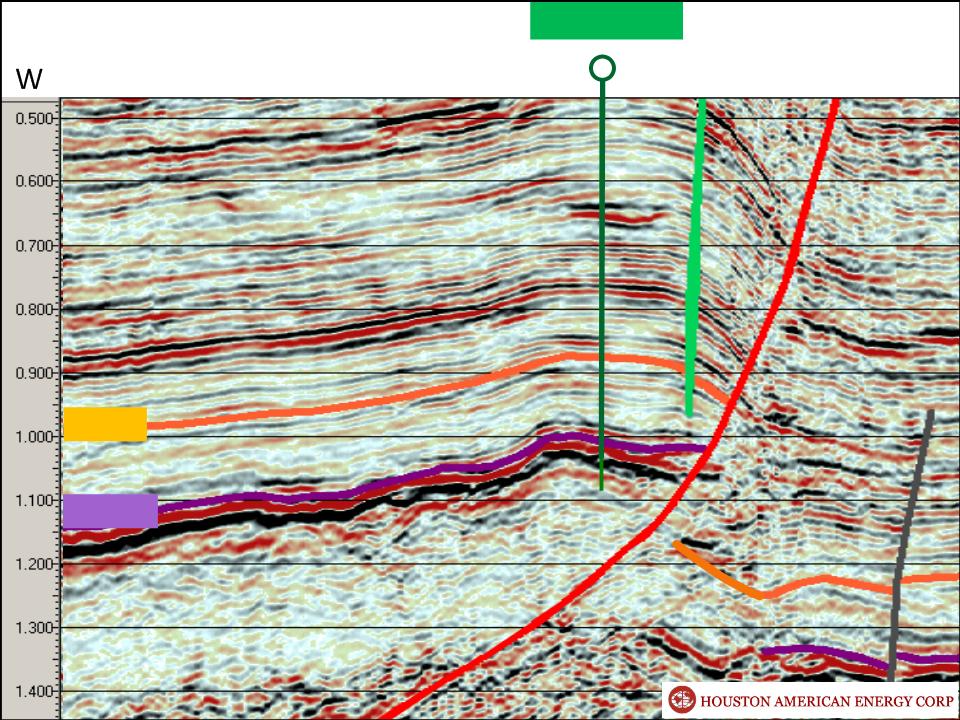
Capella Field
2D Seismic Line S2
South Prospect
NW
SE
Seismic Line
Payara 1
Capella 1
Capella 2
Source: Canacol Energy Investor Presentation - July 2012

Capella Field
Comparison of 2D Seismic Data Over Capella Field and the Serrania South Prospect
South Prospect

Mirador Interval Thickness Map
THIN
THICK
Capella Field
North Prospect
South Prospect
Mirador
Interval
370 Feet
Payara #1 (1975)
60 feet
This map shows that we may encounter a thicker Mirador interval in the Serrania Block than Capella Field.
25 feet

Capella Field
South Prospect
North Prospect
Serrania Area
1) 12.5 % Interest
2) 392,224 gross acres
49,028 net acres
3) Two Large Prospects
Adjacent to Capella Field
Shallow Wells
4) Large Amount of Follow-up
Acreage
5) Seasoned Operator
HOUSTON AMERICAN ENERGY CORP